UN
1 Sproule Close
£ 133,000
Description
We don't have a Description for this property.
- Bedrooms
- 1
- Bathrooms
- 0
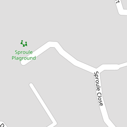


Leaflet © OpenStreetMap contributors
The heatmap indicates the level of crime in the area. The color of the heatmap indicates the crime severity and recency.
Metrics Year-on-Year
- Average area value
- 761,083.00 £Increased by 6.90 %
- Average area rental value
- 2,056.00 £/moDecreased by 3.34 %
- Est rental Yield
- 3.24 %Decreased by 9.75 %
- Crime Rate
- 17.00 %Unchanged by 0.00 %
from 711,963.00 £
from 2,127.00 £/mo
from 3.59 %
from 17.00 %
Nearby Schools
| Name | Type | Ofsted | Distance |
|---|---|---|---|
| The Villages Children & Family Centre | Children's Centre | 1.86 KM | |
| Yapton Ce Primary School | Voluntary Controlled School | Good | 2.03 KM |
| St Mary'S Cofe Primary School | Voluntary Aided School | Good | 2.53 KM |
| Walberton And Binsted Cofe Primary School | Voluntary Controlled School | Good | 4.30 KM |
| Arundel Cofe Primary School | Voluntary Aided School | Good | 4.73 KM |
Images
Nearby Streets
| Name | Average Price | Average Sqft | Distance |
|---|---|---|---|
| Langford Close | £ 0 | 0 | 0.00 KM |
| The Poplars | £ 400,000 | 0 | 0.00 KM |
| Saturn Drive | £ 775,000 | 0 | 0.00 KM |
| Neptune Way | £ 329,995 | 0 | 0.00 KM |
| Taylor's Close | £ 0 | 0 | 0.00 KM |
Nearby Transport
| Name | NLC | TLC | Distance |
|---|---|---|---|
| Ford | 5258 | FOD | 2.46 KM |
| Barnham | 5252 | BAA | 5.04 KM |
| Littlehampton | 5260 | LIT | 5.63 KM |
| Arundel | 5251 | ARU | 6.58 KM |
| Bognor Regis | 5253 | BOG | 9.43 KM |
Nearby Listings
| Address | Price | Type | Score | Distance |
|---|---|---|---|---|
| Sproule Close, Ford | £ 245,000 | BUY | 6 / 10 | 0.01 KM |
| Sproule Close, Ford, Arundel, West Sussex | £ 170,000 | BUY | Unknown | 0.01 KM |
| Sproule Close, Ford | £ 145,000 | BUY | Unknown | 0.05 KM |
| Beagle Drive, Ford | £ 250,000 | BUY | 7 / 10 | 0.12 KM |
| Lewis Lane, Ford, Arundel, West Sussex | £ 315,000 | BUY | Unknown | 0.14 KM |
Nearby Properties
| Address | Price | Distance |
|---|---|---|
| 45 Sproule Close | £ 146,000 | 0.00 KM |
| 43 Sproule Close | £ 135,000 | 0.00 KM |
| 3 Sproule Close | £ 131,500 | 0.00 KM |
| 35 Sproule Close | £ 192,500 | 0.00 KM |
| 51 Sproule Close | £ 127,500 | 0.00 KM |